πŸ—ΊοΈ Property Map

Interactive map showing the exact property boundaries and location

Loading map...

Interactive property boundary map located in Red Hills (Rural), St. Andrew parish, Jamaica.

Tax & Investment Information

πŸ”’ Tax Compliance Status
Property Value: πŸ”’ Hidden
OwnerπŸ”’ Hidden
Annual TaxπŸ”’ Hidden
Total DueπŸ”’ Hidden
Total PaidπŸ”’ Hidden
OutstandingπŸ”’ Hidden
Tax Payment History
Tax YearTax AmountPenaltyInterestTotal DuePaidOutstanding
2024πŸ”’ HiddenπŸ”’ HiddenπŸ”’ HiddenπŸ”’ HiddenπŸ”’ HiddenπŸ”’ Hidden
2023πŸ”’ HiddenπŸ”’ HiddenπŸ”’ HiddenπŸ”’ HiddenπŸ”’ HiddenπŸ”’ Hidden
2022πŸ”’ HiddenπŸ”’ HiddenπŸ”’ HiddenπŸ”’ HiddenπŸ”’ HiddenπŸ”’ Hidden
Investment Notes

πŸ”’ Complete tax compliance analysis, property valuation, and investment insights available after purchase.

AI-powered estimation based on comprehensive analysis of location, demographics, infrastructure, and market factors

Estimated Value (JMD)
JMD 182,180,922
Estimated Value (USD)
USD 1,214,539
Confidence Score
95%
Market Multiplier
1.12x
πŸ“Š Value Range Analysis
JMD Range:
JMD 145,744,738 - JMD 218,617,106
πŸ“Š Analysis Details
Summary: AI analysis indicates a land value of JMD 182,180,922 based on 95% confidence analysis of population density, building count, facilities, and environmental factors.
Key Factors: Population density: 95535 people β€’ Building count: 6 β€’ Nearby facilities: 0 β€’ Environmental score: 0.0% β€’ Economic score: 0.0%
Tax Status: Available
Legal: Property appears to be legally registered
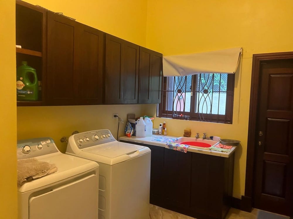
Improvements: Property has existing structures

Detailed analysis of buildings, attractions, and amenities in and around the property

🏒 Buildings Inside Parcel (6)

construction
Building type: construction
πŸ†” OSM ID: 781436982
🏷️ OSM Type: way
🏒 Building Type: construction
yes(2 levels)
Building levels: 2
πŸ†” OSM ID: 781436983
🏷️ OSM Type: way
πŸ—οΈ Levels: 2
🏷️ roof:shape: gabled
yes(1 levels)
Building levels: 1
πŸ†” OSM ID: 781436985
🏷️ OSM Type: way
πŸ—οΈ Levels: 1
🏷️ roof:shape: hipped
yes(2 levels)
Building levels: 2
πŸ†” OSM ID: 781438717
🏷️ OSM Type: way
πŸ—οΈ Levels: 2
🏷️ roof:shape: flat
yes(1 levels)
Building levels: 1
πŸ†” OSM ID: 781438718
🏷️ OSM Type: way
πŸ—οΈ Levels: 1
🏷️ roof:shape: gabled
yes(1 levels)
Building levels: 1
πŸ†” OSM ID: 781438719
🏷️ OSM Type: way
πŸ—οΈ Levels: 1
🏷️ roof:shape: flat

🏒 Amenities (5)

yes(1 levels)
Building levels: 1
πŸ“ Distance: 12m
πŸ†” OSM ID: 781436984
🏷️ OSM Type: way
πŸ—οΈ Levels: 1
🏷️ roof:shape: gabled
yes(2 levels)
Building levels: 2
πŸ“ Distance: 19m
πŸ†” OSM ID: 781436986
🏷️ OSM Type: way
πŸ—οΈ Levels: 2
🏷️ roof:shape: hipped
construction
Building type: construction
πŸ“ Distance: 26m
πŸ†” OSM ID: 781436981
🏷️ OSM Type: way
🏒 Building Type: construction
yes(1 levels)
Building levels: 1
πŸ“ Distance: 32m
πŸ†” OSM ID: 781436987
🏷️ OSM Type: way
πŸ—οΈ Levels: 1
🏷️ roof:shape: gabled
yes(2 levels)
Building levels: 2
πŸ“ Distance: 32m
πŸ†” OSM ID: 781437001
🏷️ OSM Type: way
πŸ—οΈ Levels: 2
🏷️ roof:shape: hipped

πŸ–οΈ Nearest Attractions (1)

park
Distance: 226.9mπŸ“ View Location

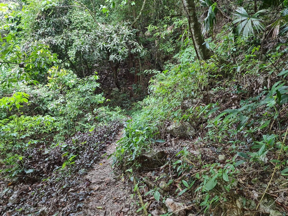
🌊 Nearest Natural Features (4)

wood
Distance: 72.4mπŸ“ View Location
wood
Distance: 110.0mπŸ“ View Location
wood
Distance: 441.6mπŸ“ View Location
wood
Distance: 2.3kmπŸ“ View Location

πŸ›£οΈ Transport Infrastructure

footway
Distance: 12.3m - Type: footwayπŸ“ View Location
footway
Distance: 53.7m - Type: footwayπŸ“ View Location
footway
Distance: 71.8m - Type: footwayπŸ“ View Location
footway
Distance: 90.3m - Type: footwayπŸ“ View Location
footway
Distance: 156.0m - Type: footwayπŸ“ View Location

πŸ” What's Included in Full Access

πŸ“‹
Ownership InformationCurrent and historical ownership records
πŸ“
Precise BoundariesExact property boundaries and dimensions
πŸ’°
Valuation & Tax DataCurrent assessments and tax information

This property is located at INDUSTRY GROVE, Paradise Road, Red Hills (Rural), St. Andrew, Jamaica in the PADMORE P A area.

Our comprehensive property database includes detailed information such as property boundaries, coordinates, ownership records, and tax information. This property in offers investment opportunities within Parish, one of Jamaica's 14 administrative parishes known for its unique characteristics and development potential.

Property Details: Below you'll find complete property information including interactive maps, boundary details, volume/folio references, lot numbers, and precise geographic coordinates. This data is essential for property investment decisions, development planning, and real estate research in , .

CL-42272, INDUSTRY GROVE, Red Hills (Rural), St. Andrew

ID: 42272

Complete property address and location information

Area/LocationPADMORE P A
πŸ™οΈ NeighborhoodPADMORE P A
Full AddressINDUSTRY GROVE

πŸ“ Location & Boundaries

Coordinates: 18.082932, -76.844532

Property boundaries: Database polygon data available

Precise boundary information and ownership details available with full access.

🏠 Real Estate Investment Opportunities

Discover properties for sale and rent in this prime location. Perfect for investors looking for opportunities in this growing area.

πŸ’°Properties for Sale

2 Available
Lot # 48, 62 Bellevue Drive, Smokey Vale , Kingston 19, Jamaica, Arcadia, Saint Andrew, Arcadia, Saint Andrew
FOR SALE
1 / 10

Lot # 48, 62 Bellevue Drive, Smokey Vale , Kingston 19, Jamaica, Arcadia, Saint Andrew, Arcadia, Saint Andrew

USD $1,998,000

πŸ›οΈ7 beds
🚿6 baths

πŸ‘¨β€πŸ’ΌAndrea Green

🏒RE/MAX ELITE REALTY Kingston

CAVALIERS, ST ANDREW
FOR SALE
1 / 10

CAVALIERS, ST ANDREW

JMD $6,300,000

πŸ“460,864.98 sq ft

πŸ‘¨β€πŸ’ΌMarlene Williams - - Williams - - Mba

🏒MARLENE WILLIAMS REALTY LIMITED

🏠Properties for Rent

0 Available
🏠

No Properties for Rent

Currently no properties available for rent in this area.

πŸ“Š Investment Summary

2
Properties for Sale
0
Properties for Rent
2
Total Opportunities

Checking access...